Tuesday, September 20, 2011

Last of the flowers?


I did manage to get a few nice wildfower shots on our trek to Cardiff Pass. I thought I should share them as they may very well be the last of the good flower shots this year. Fall comes quickly. Oh, and a cool mushroom shot too! We don't see a lot of mushrooms here, so it's always exciting to stumble upon a really nice one!


A most adventurous hike... or my life as mountain goat!

We were not the only mountain goats!

Our 9/11 hike started as a low key event. We hadn't made a real plan, but met early at Susan's, our normal rally point, where those who studied their hiking books tossed out a couple of ideas. We decided to head up Cardiff Fork, an area none of us had hiked before. This hike starts at the same trailhead for 
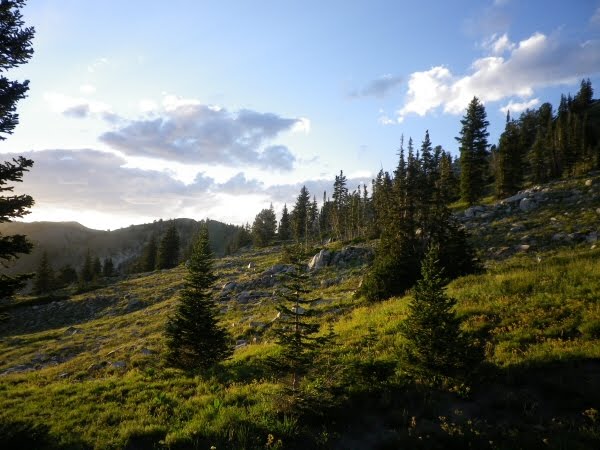
Donut Falls, an extremely popular short hike in Big Cottonwood Canyon. Anyone who hikes at all has probably been to Donut Falls, but I've not really heard of anyone hiking up past the falls, perhaps because there are no lakes or "easy" summits up that drainage? Or perhaps because it was a more "industrial" area of the canyon. While we enjoy the wilderness of our canyons, we tend to forget our rich mining history, and that during the late 1800's the canyons were not pristine recreation areas, but heavily mined and deforested.

We headed back along the Donut Falls trails, and then the adventure began... our choice of trails and mining roads, with no clear indication of which was the trail to Cardiff Pass. We chose the trail rather than the road, and found an obstacle course of fallen trees to climb over, a few interesting creek crossings, and eventually found ourselves on a road anyway. As we approached the old Cardiff mine there were plenty of forks in the road and plenty of "No trespassing" signs. We kept chosing the high road and ignored the signs. The roads disappeared into a trail which continued past tailings piles and open mine shafts. We eventually found ourselves in a large cirque surrounded by rocky ridges, and we located, by virtue of the telephone pole on top, the one that must be Cardiff Pass.

The trail pretty much petered out at that point and we started picking our way up the steep hill. Rebecca kept saying "There have to be mountain goats up here somewhere". The goats are rare, and not easily seen so it would be quite the coup to spy some. Suddenly Ron, her husband, stops and points. Up ahead on the rocks there is movement, closer attention reveals a whole herd of mountain goats, meandering up toward the ridge. We carefully head up in that direction so that we can get a closer look. There are at least 7, bucks, does and kids. It is amazing to see how easily they climb the rocks.

We find ourselves close to the base of the near verticle rock face, and need to traverse quite aways across to the point we can ascend to the ridge. It is really steep, steeper than you can really tell in the pictures, and the slope is full of lose rock and scree. We pick our way carefully across, practically on all fours at times, as staying low with our hands on the rocks felt much more stabil, and none of wanted to slip and fall. The final ascent up on to the ridge was even steeper, with a fallen tree to cross over to add to the fun. At one point a big rock was dislodged and went tumbling, barely missing Ron. A fun little challenge for sure, but we made it, on all fours, up to the top where we had an incredible view of Alta Ski Resort in Little Cottonwood Canyon, as well as the view back down Cardiff Fork to Big Cottonwood Canyon.

From the ridge we found an actual trail down in the other direction, a good thing, as none of us wanted to go back down the very steep way we came up. That trail eventually petered out and we ended up making our way down a steep vegetated slope. Not as steep as on our way up, but still challenging as the dense vegetation hid all the loose rocks, so you had to gingerly step and make sure your were on solid footing and that the rocks weren't going to roll before transfering your weight. As things flattened out we eventually made our way back to trail we came up, and from there we followed the the old mining road down.

At one point there was a nice meadow on the left. I looked up and said "There really ought to be a moose up there" as I thought it really looked like moose habitat. Not a minute later Susan spied a big bull moose up the hill in the trees.

What a great hike! 6.5 miles round trip, 2400 foot elevation gain, an adventurous scramble throught steep, rocky terrain. And mountain goats!!! Lots of mountain goats. And a bull moose!!! We really could not have asked for more exciting day.

Cardiff Mine

The narrow trail is up the hill on left side of this open mine shaft. Would not want to slip off the trail here!


Still a bit of snow!

Picking our way across the cirque

On Cardiff Ridge


Alta


The view back down to Big Cottonwood Canyon

Yeah, we came up that!

Hello Bullwinkle!


Rebecca took this shot... it almost shows the steepness of our climb... you can see why we didn't want to fall as we climbed to ridge near the fir trees!

I have to have at least one wild flower shot...right? Parry Primrose,a lovely alpine flower from just below the rocks.

Thursday, September 08, 2011

Treats and Trips on the Trail...


From high on the trail towards Lambs Canyon Wednesday night

The days are getting shorter so last nights hike was a pretty fast hike up to the ridge that separates Millcreek and Lambs Canyon. It is the second time I've been to that spot this week, on labor day we hiked up to the ridge from Lambs Canyon. Yesterday we hiked from the Millcreek side, so I was able to take my Daisy dog. The hike was only 4 miles round trip, but like most Millcreek trails it was pretty steep, so it was a pretty good work out for my poor 11 year old dog.

Since tonight I figured she would be a little stiff and sore I decided to take her up the canyon for a nice easy stroll along the Pipeline Trail. Unlike most of the Millcreek trails, which head straight up the mountains, the Pipeline Train is fairly flat trail cut into the hillside kind of paralleling the road. As the road descends into the valley the pipeline trail stays high, clinging to the uphill side and dropping off on the side that heads down the hill to road. The trail starts in the woods then heads out through open hillsides interspersed with wooded areas as it crosses various drainages. I don't do this trail often, as it's not much of a workout, and not quite as scenic as many of the other trails. But I was glad I took it tonight because I found a wonderful treat along the way.

Dragonflies. Dozens and dozens of dragon flies. Darting and flitting and swooping all over the hillside on the open part of the trail. I have never in my life seen so many dragonflies. I love dragonflies and they were quit entertaining to watch. It certainly made taking the boring, easy trail worthwhile.

After the treat I had my "trip"... Here I am on the easiest trail and I manage to have hiking accident. Like I said, the trail drops off on the south side, and is fairly narrow in places. No big deal to a hiker, but a little more unnerving if you are on a mountain bike. It is a very popular bike trail, and when bikers pass I usually let them pass on the uphill side of the trail because I know how scary the drop off are from a bike. As I headed down one of the drainages I saw some mountain bikers approaching. Having biked the trail a few times myself I knew that after rounding the tight turn at the creek bed they would want a bit of speed to pedal the short hill out of the draingage, so I wanted give them clear berth to climb the hill. So I stepped to the downhill side of the trail, and yanked Daisy's leash to pull her toward me.

Well, Daisy is not too bright, and doesn't "get" that she needs to step aside. She always leaves her butt hanging in the middle of the trail. So I reach down and grab her hindquarters to pull her to me. Her sore hip collapses and she falls toward me. I'm standing on the edge and as she bumps into me I feel the ground crumble underneath my feet. Next thing you know I am tumbling down the hill, with Daisy tumbling down on top of me. I manage to twist my feet forward to try to dig in and stop sliding but the branches from the shrubs make it impossible to get a grip. Daisy rolls over me, and I grab for her, because I am worried she will twist and break or tear something, or strangle by her collar since shes on lead. It sure felt like quite the tumble but in reality I had managed to to arrest our fall 6 or so feet down the hill. After we untangled from the branches and each other we were able to stand up and gingerly make our way down to the bottom of the creek bed and up the other side to the trail. So much for us stepping aside so the bikes could speed up the hill, because they of course stopped when they saw us tumble.... I think they were pretty relieved to see us stand up.

Poor Daisy! Here my plan was to let her have an easy walk to recover from the big hike, and now she's probably more sore than when she started. I am really thankful she was not hurt. I have a few good scrapes, a slightly tweeked back and perhaps a future bruise or two...(and panties full of dirt LOL, but nothing to worry about. I'm laughing about it as I'm sure it was quite comical, and I'm enjoying the irony of having fallen on the easiest trail. I guess even an easy stroll can be an adventure.

Sadly I didn't have my camera tonight, and likely couldn't have captured the magic of the dragonflies anyway, so my pictures are from previous 2 hikes up to Millcreek/Lambs Canyon divide.

Overlooking Millcreek on Labor Day

Around the same place on Wednsday.... fall is clearly in the air as things have died back quite a bit in a few days time.

Wildflowers are being replaced by seeds and berries.


Thursday, September 01, 2011

Meet my new friend Katy


Katydid that is. I came downstairs this morning and found this fellow up in the corner of my dining room. I thought he was pretty so I let him hang out. I like Katyids, they are pretty cool looking. The funny thing about bugs...what makes some bugs friends and other bugs foes? I have to admit, had I come downstairs and found a 2 inch spider lurking in the corner of the dining room I would have been freaked, not amused, and that spider would likely have seen an untimely death. But Katydid? He was more than welcome to stay.

I was pleased that he was still around when when I came home tonight. I liked watching him. Unfortunately, Oreo, my cat, was also pleased to see him...and stare at him, and wait for him to move, then chase the poor fellow as he flew ... We had quite a bit of "psycho kitty" going on tonight as he chased the Katydid around the house. Eventually the Katydid lost altitude and got within Oreo's reach, and I felt compelled to to intervene and rescue the poor fellow. So back out the window he went. I was bummed, as I had enjoyed having a new friend in the house and hoped he would get to stay a little longer.

Bushwacking Wednesday...


OK, it is supposed to be "hiking Wednesday", but sometimes a good trail is hard to find. Today was one such day. It was mystery hike night. We had no plan, except to meet at Susan's and make a plan. Someone suggested Grizzly Gulch, up near Alta in Little Cottonwood Canyon. We weren't exactly sure where to find the trail though. Jess thought she knew, so we parked and headed up a narrow trail, straight up the mountain... into the willows, where it sort of disappeared. We bushwacked our way up to the cabin road, but once there, couldn't find the trail. We headed back down through the aspens, an easier route, and then found a trail alongside the gulch's creek. Alongside the creek, through the creek, scrambling over rocks and up steep creek beds. I wasn't entirely sure it was really a trail either, except for the deer, but after finding a tiny car wreck in the creek we knew someone besides deer has traveled that route. Finally, after scrambling up the steep hillside along the creek, we came over a ridge and found, ta-da, the old mining road that led to grizzly gulch.

From there finding the way was easy, a steep rocky road that wound through old mining areas, then narrowed into a trail, that took us to Twin Lakes Pass. The trail ascended about 1200 ft in a couple of miles, but seemed harder than it was, as we were hiking quickly since we knew that our slow bushwacking start meant we were racing the sun. We made it up to the pass, took a quick photo op, and headed down in the setting sun. A beautiful setting sun, which more than made up for the slow bushwacking and scrambling start of our hike.

Scrambling through the creek.


Up the gulch


A small car wreck!


Remnants from the mining days.

Twin Lakes Reservior, from Twin Lakes Pass